THE LAGUNAS ROUTE DETOURING FOR VOLCANO UTURUNCU on THE ALTIPLANO OF SOUTH WEST BOLIVIA
Uyuni - San Juan - Laguna Hedionda - Laguna Colorada - Quetena Chico - Volcano Uturuncu - Quentena Chico - Polques - San Pedro de Atacama
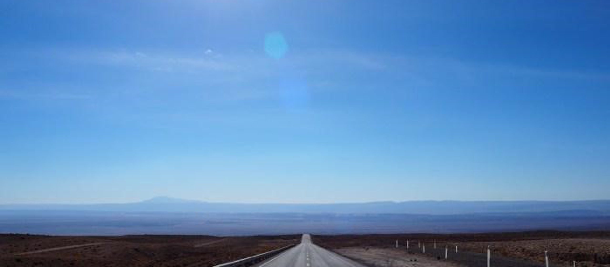
Cycling the sandy corrugated 4000+metre high desert roads of Southwest Bolivia for hundreds of kilometres is undoubtedly tough. I agree with Scott Pauker, you have three riding options: ride standing up off the seat and exhaust your legs, ride seated at an excessively slow speed or ride normally and have your backside mercilessly pounded by your seat (perhaps fun for some?). Maybe there's one more option...you could always go off road into the deep soft sand...
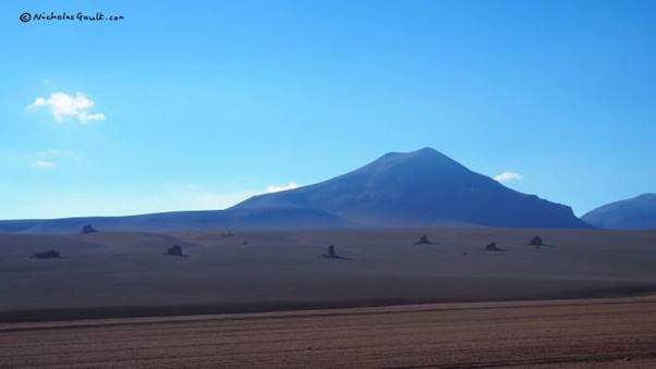
A place has to be very special to put oneself through ten days of this type of riding. And Southwest Bolivia is indeed very special: hundreds of kilometres of spectacular desert landscapes peppered with flamingo-filled salt flat lakes set to an impressive volcanic backdrop; camping in the some of the clearest star-filled night skies planet Earth has to offer. It's understandably popular among bike tourers and had been on my radar since well before my trip cycling south from Alaska began.
It requires a fair amount of preparation due to the fact that, well, you're in a freaking 4000 to 6000 metre high altitude desert in the middle of the mighty Andes miles from civilisation: there are limited water and food re-supply options and various climatic hardships to deal with; relentless sun, gale force afternoon winds, below freezing at night (in winter as much as -20 C), occasional (quite nasty) sandstorms etc.
Miles from civilisation? Well if you exclude the occasional jeep tour that flies by without regard for human life coating you in sand and dust. The jeeps totally change the dynamics of the experience since rescue would only be a matter of waiting a few hours for one of 'them' to pass. Although, ironically, the way they drive they're probably the biggest hazard out there by a considerable margin. I heard of cyclist who sadly came to grief by their hands.
The conditions significantly favour a lightweight fat tyre bike setup but the notoriety of this place repeatedly lures in those with 50 kilograms or more who end up arduously hauling their beasts through the sand at an unbearably slow rate for days on end. Not that appealing: go as light as possible.
Here's a photo diary of my ten days in the desert from Uyuni (Bolivia) to San Pedro de Atama (Chile) via the main Lagunas route. It includes my 150 kilometre detour to ride another 60 kilometres up and down one of the highest roads in the world on the 6008 metre volcanic beast known as Uturuncu. This volcano side trip sits high in the hall of fame experiences for the entire trip; if you've got the energy, don't miss it!

After only a few kilometers I stumble across the first of several tourist magnets I would see over the next ten days. It's inundated with jeep tourists; I’m later than expected so I don't hang around at Uyuni's "train graveyard".

The train line continues towards San Juan but a highly unwelcome headwind gradually creeps up throughout the afternoon and by the time the sun starts dipping beyond the horizon I am barely managing a walking pace. For 20 minutes I indecisively consider a very poor camp spot by a small bridge on this MASSIVE open plain that connects with the Salar de Uyuni. With the last few moments of the day’s light rapidly slipping through my fingers I am saved by my zoom lens whilst taking photos of this sunset. I spot a potential shelter several kilometers away and battle on to camp just short of Rio Grande.
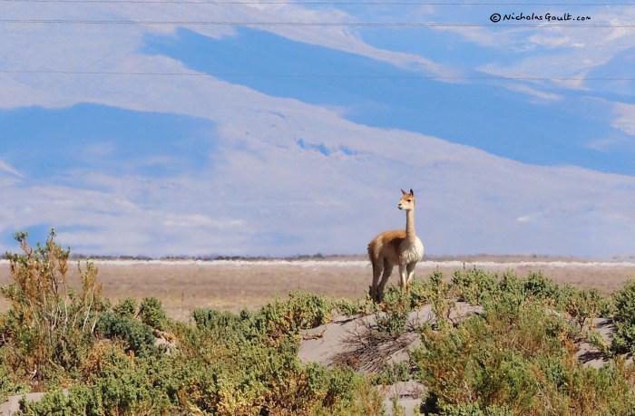
Roaming extensively around the altiplano, these vicuña are shy animals and start to run whenever I get close. However, they are fortunately unaware of my powerful zoom lens and I steal a few shots from a distance.
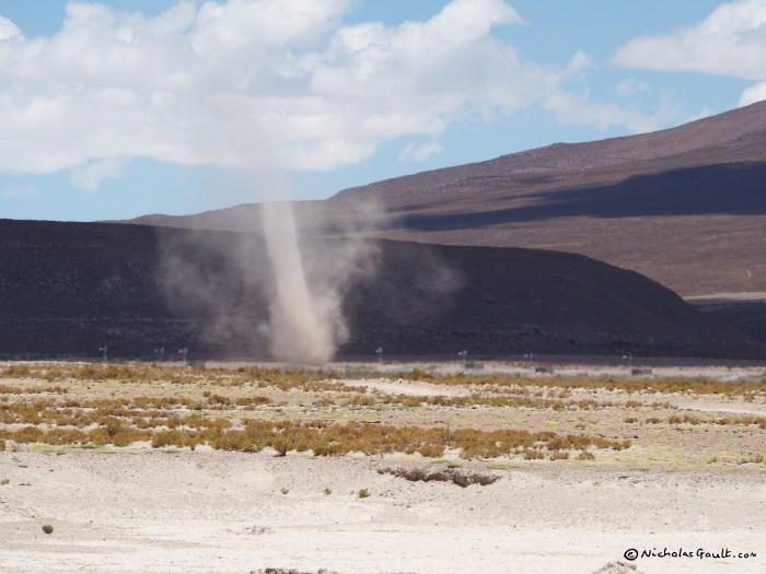
My first of many afternoon whirlwinds. Not unlike like a lunatic moving randomly obliterating anything in their path.
After stocking up on dry food (oats, rice, pasta, bread etc), the owner of a grocery store in San Juan lets me sleep on her floor upstairs. When a huge sandstorm violently smashes through the village for half an hour just after sunset I am extremely thankful to not be camping outside.
The next morning I start on the main laguna route but utterly gormlessly go the wrong way for several kilometres. After a certain amount of self-flagellation I get on the right route and cross the Salar de Chinguana after filling up with water at the military basecamp.

After cresting the steep rocky sandy pass up from the Salar I find possibly the best camp spot on the altiplano. Spot my tent; sheltered from the wind in all directions by an intriguing rocky outcrop. Wind shelter at night is of high priority out here.

Laguna Canapa flamingo.

In Laguna Hedionda I bump into two other cycle tourists who I have met in Uyuni a few days earlier. With their heavier load, their pace is a little slower. Brice from France has managed to score a temporary job as a chef in the restaurant. I am not, however, a professional chef so I continue on under the brutal sun into the wind after scrounging a chicken and rice hand out from a jeep (making a welcome interruption from my Bolivian biscuit diet).
- Is that the same one we saw in Laguna Canapa?
- I think it is... Yeah it is.
The types of conversations I overhear from tourists talking about me as if I'm not there.

After a night at 4500 metres and countless more kilometeres of corrugated sandy roads that would test the mental fortitude of the most stoic philosophers, I find myself at an unusually gringo free arbol de piedra.

I pay the 150 Bolivianos to enter Reserva Eduardo Avaroa at Laguna Colorada and cycle the park ranger's seven “short” kilometers to Huayllara that actually turn out to be twelve gruelling (you guessed it) washboarded sandy rocky kilometers against a now very familiar mojo crushing headwind. Hours later I arrive and my luck turns when some particularly kind tourists feed and bed me in their refugio.
With my spirit rejuvenated I decide to detour to climb Volcán Uturuncu. A decision I haven't taken lightly since this will add on 210 kilometers and an unknown number of days to the trip. Not to mention a huge climb up to over 6000 metres. I ponder my sanity as I elevate myself incredibly slowly up a solid 500 metres of altitude over the pass towards 'basecamp' (aka the windswept dusty town of Quetena Chico). The road isn't perfect but it's virtually a motorway compared to the previous few days of the trip.

On cresting the pass the tip of my planned target starts coming into view (the 6008 metre beast) and I stumble across this rather twitchy herd of vicuñas. Again they are oblivious to the powers of my telephoto lens.
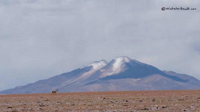
The double peaked volcano then starts coming into view.
In Quetena Chico I reach a low point when I discover it is not a town full of delicious authentic Bolivian restaurants serving freshly cooked meals. There seems to be only wind and sand on offer and no one really gives a damn about me.

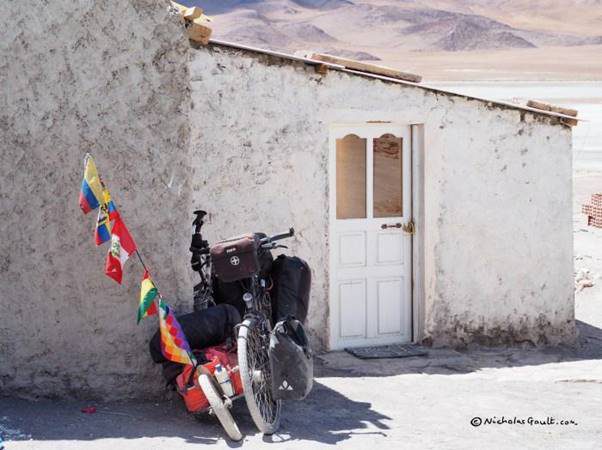
However, after purchasing some very basic provisions at the only 'tienda' that I can find open (it's Christmas Eve after all), I manage to somehow talk the owner into giving me an empty room with a concrete floor to set up my official basecamp. To the non-bike tourer this may sound rough, but to the initiated this is a dream come true. Complete with courtyard water supply. Sorry no bathroom, "you'll have to use the desert".

Bonus extra: a 'bedside' view of the task at hand.
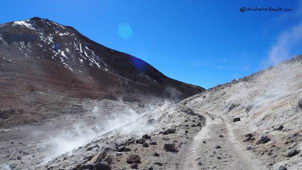
I am far too excited to sleep properly but try to bed down at 8pm anyway. At 11.45pm I've hardly slept a second and my alarm goes off. I jump to action ducking out to the desert for the first of many 'bathroom' visits that plague me throughout the climb. I set off at 12.40am from 4150 metre Quetena Chico passing a 'guides obligatory' sign which serves to confirm the start of the trail.
For the first time ever I am able to cycle with my down jacket on and not overheat, it's a cold night; in fact I'm cold the whole time, making inconvenient 'bathroom' visits rather uncomfortable. And with no moon, everything is pitch black except the huge array of stars. I pause after half an hour to put on my alpaca gloves to protect my freezing fingers. Suddenly, I am startled by the sound of a bell very close. I put my torch in its direction and see nothing. I continue and the noise follows me making me feel unsettled. Some kind of farm animal, a llama perhaps? I then see a light 500 metres to the side where there should be no one with some kind of water reflection; this stays in view for the next two hours as I climb the volcano. I never discover what it is (even the light of the day offers no explanation; I only see empty desert where the light was).
After nearly 8 hours of laborious climbing on this steep rocky road I approach the top of one of the highest roads in the world and arrive at the col between the two peaks (5760 metres).

And then, after over an hour of slow purposeful plodding and precautionary pausing to breathe incredibly deeply I make it to the summit. 6020 metres says the sign.
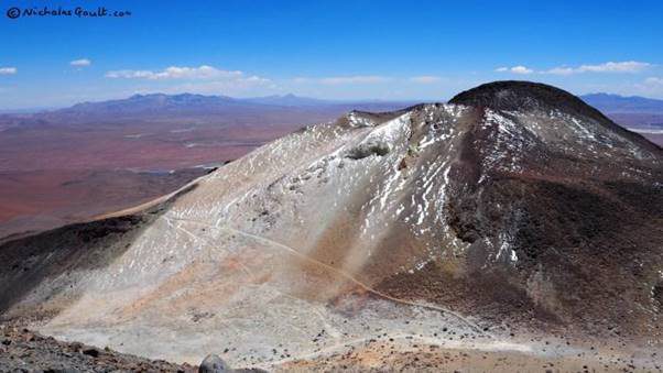
The lower neighbouring peak sits majestically below. You can see the road continues up a few more metres for those obsessed with cycling as high as possible (I wasn't).
And then a three or four hour hair raisingly fast and rocky descent sees me back at basecamp for biscuits and sardines at 4pm. I celebrate with an orange that I've carried since Uyuni.

Against all odds my tummy clears up and the next morning I purchase my entire bodyweight in biscuits: the primary food source of Southwest Bolivia.
This is the last food stocking opportunity until San Pedro, two or three days away. The options are extensive - would sir like salt or sweet?

I head off to Polques somewhat tired after my 15 hour ordeal the day before experiencing last glimpses of Uturunco. Isn't the length of an ironman only seven or eight hours?


Another 500 metre pass comes into view. This one has an average gradient of 11%.

But before I get there I pass a 'Bofedal' - some kind of fragile oasis ecosystem.

Just looking at it makes me want to dive in and drink the entire pond.

I don't however, and admire the various livestock camelides (llamas etc) from afar before racing up the steep pass at impressive speed. (although I say so myself).
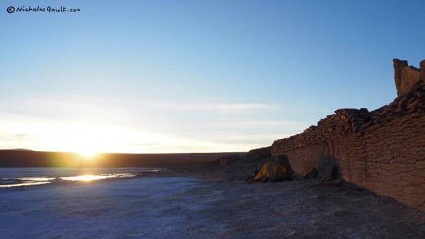
Kollpa Laguna - some kind of a sodium mine. The predictable extreme headwind forces a 4pm camp next to this wall (as rare as rocking horse shit in these parts, I think the saying goes).


Then my route rejoins the main lagunas route...

...to Polques hot springs. When I get there I find the largest number of jeeps I've seen in my life. Exhausted and hangry, it’s not what I have in mind, I can't even find somewhere comfortably to sit out of the midday sun. The documented promises of a quiet evening to myself wallowing indulgently in 'healing waters' never materialise and an evening group arrives full of unwelcome Christmas spirit. Repeated loud beer requests continue into the night as I lie on the restaurant floor trying to block the buggers out of my mind.

And then its back to the washboard.
9 kilometers on. Nicknamed Desierto (Salvador) Dali. Quite a cool sight marred slightly by...

...an incredible consistent stream of jeep traffic. Today there are 10 times the number of any of my previous days and they're in a hurry. Between Polques and the border their appalling driving skills have me concerned for my personal safety. (This is the only day they actually make me feel unsafe).
(NB: Some speculation based on my purely one off anecdotal experience: it makes sense that Laguna Colorada to San Pedro would hold the worst traffic, alternative routes seem to all converge for this section. The time of day also makes a difference, they seem to move in herds.)

So, after a certain amount of swearing and sign language at the main offenders, I resort to cycling on the sandier alternatives...

and a baby vicuña soothes my spirits.

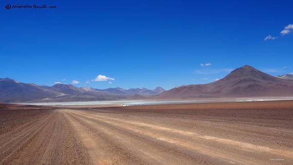
Laguna Verde and Volcano Licancabur. Beautiful isnt it? But wait...

.... I manage to arrive on the busiest minute of the year. Still, after long periods alone in the desert the company isn't so bad with the odd person flattering me with massive interest in my trip. Twenty minutes later it's empty.
Last shots of the majestic park. What you can't see is the wind. The last five kilometres up to the border turn out to be some of the slowest cycling moments in history.

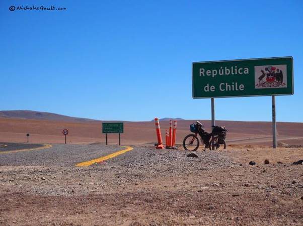
Bolivian immigration, a basic affair. The “documented” and expected 15 BOL exit tax scam I’d be warned about never materialises.
Brand spanking new pavement and 47 km to San Pedro. Energy comes from nowhere and I speed up the final 5 kilometres to the top of the Chilean pass

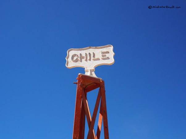
And then the exhilarating massive smooth descent to the tourist oasis San Pedro de Atacama. Buffeted heavily by crosswinds, I proceed somewhat cautiously but am delighted, the drivers that pass me do so with a respectable amount of space. I then breeze through customs in San Pedro which proves to be a slick operation. Thank you Chile.
ROUTE NOTES:
Interactive route map and gpx here: https://ridewithgps.com/routes...
Note: I plotted this route after my ride using a mix of other people's gpxs, it is a rough guide to what I did. It does not include the exact route to the top of 6008 metre Uturuncu, this should be downloaded separately.
From Uyuni to San Pedro I took ten days going a reasonable distance each day. The required deviation to Quetena Chico / Uturuncu (between Laguna Colorada and Polques) had some pretty good road surfaces most of the time and were definitely better than the main route. It only adds two or three days to the trip but includes two 500 metre pass in addition to 2000 metres of climbing to Uturuncu and 210 kms, so obviously a fair bit extra to do. In my opinion though, WORTH IT.
Overall itinerary (suitable for a reasonably lightweight setup, I never needed more than two days of water)
Day 1 to 2: Uyuni to San Juan along railway (good supplies available in San Juan but no cooked meals)
Day 3 to 5: To Laguna Colorada (supplies available) water available halfway at Laguna Hedionda)
Day 6: To Quetena Chico 'basecamp' - basic food supplies here
Day 7: Climb up and down Uturuncu (full day)
Day 8 To Kollpa Laguna (all the way to Polques would be possible if you leave early) - bring three days of food from Quetena Chico (two if going fast)
Day 9: To Polques (was less than half a day)
Day 10: To San Pedro.
My estimated Uturuncu itinerary: some people camp halfway up doing it in two days from Quetena Chico but it's perfectly doable as a 'day' trip which is what I did. I wouldn't leave later than 2 or 3 am. I left at 12.40am because I wanted to ensure that I'd arrive at the summit before midday as poor weather risk seems to increase after this time. I was sick and I hung around at the top for a while so my time is OK but not super fast. I was able to cycle entire thing pushing only a matter of a few metres in total.
- 12.40am leave Quetena Chico
- 3.15am (13.1km mark) - start the relentless climbing.
- 4.40am 4700 metres
- 6.30am 5200 metres
- 9am 5760 metres - at the col.
- 10.30 to 11 am - at the summit.
- 12.10 pm - start descending
- 4pm back in Quetena Chico.
Other resources:
- Full document on Lagunas Route (with food / water / camping locations etc): TourTK
- GPX of the main lagunas route from San Juan to San Pedro: Medium.com
- GPX and notes for: Uturuncu (bikepacking.com by the Pikes; also see their notes on AndesbyBike)